The bicycling-related Internet-o-spere's all
a-Twitter about the
new bicycle routes feature on Google Maps that made its debut today. Granted, it's a long-overdue addition to this already incredibly useful resource. I'd heard the feature was coming some time ago. But I'd kinda forgotten about it until I caught wind of it earlier today.
After work this afternoon, being somewhat less than totally stoked to head out right-away into the second straight day of near-blizzard-like conditions, I spent a little time running this new feature through its paces.
The good news is, in general, it seems to work. It pretty much nailed what I'd call the
safest route (though perhaps not quite the fastest) for my daily bike commute to and from work.
But what really surprised me was when I requested a route from Flagstaff, Arizona, to Scottsdale, Arizona, the town where I grew up.
See, I actually tried to ride to Scottsdale once, back when I was really into long, lonely, road rides. I got as far as Prescott the first day (a good century), going by highway through Williams, Ashfork, and Chino Valley
into 25 MPH headwinds before bagging the whole affair, telling myself I'd return to finish it another day.
Well, it's been several years, and I've yet to complete the journey. But I'd still like to. Someday. And today, I decided to ask the
Google Maps Genie what route it would take.
I was, in a word,
shocked by the results this seemingly simple query returned! I figured it would route me down I-17 or I-40, maybe down Highway 89a through Sedona, or across Lake Mary Road and then through Payson and down the Beeline... something sensible... on
paved roads, ya know. Instead, I got this monster-epic! And, honestly, it really looks like fun.
It's a magnificent route!
And
completely unexpected.
And
totally impassable part of the year (like now).
And, to say the least, it's
quite difficult to imagine it being done as a double-century by most normal human beings in the estimated time of
18 hours (and 27 minutes)!
But it just might make for a great multi-day endeavor one of these years. Never know...
Just gotta get my long-mile-legs back under me, and then...
Start: Flagstaff, AZ
End: Scottsdale, AZ
Time:
18 hours, 27 minutes!
Distance: 202 miles
[
download/view route as .pdf]
[
view route in Google Maps]
Directions:
Start at: Flagstaff, AZ
1. Head east on Historic U.S. 66 E/I-40 BUS E/E Santa Fe Ave toward N Beaver St - 299 ft
2. Turn right at Beaver St - 0.3 mi
3. Turn right at W Butler Ave/W Clay Ave - 341 ft
4. Turn left at S Humphreys St - 331 ft
5. Turn right at W Dupont Ave - 36 ft
6. Turn left at W Dupont Ave - 0.6 mi
7. Turn right at University Dr - 121 ft
8. Turn left at Campus Heights St/Runke Dr - 0.2 mi
9. Turn right to stay on Campus Heights St/Runke Dr - 0.1 mi
10. Turn left at S Knoles Dr - 0.3 mi
11. Turn right at E McConnell Dr - 0.4 mi
12. Turn left at Fort Tuthill (Flagstaff Urban - University Heights to Fort Tuthill) - 1.4 mi
13. Turn left to stay on Fort Tuthill (Flagstaff Urban - University Heights to Fort Tuthill) - 0.6 mi
14. Turn right at Purple Sage Trail - 39 ft
15. Continue onto Forest Service Rd 532 - 1.1 mi
16. Turn left at Forest Service Rd 231/S Woody Mountain Rd Continue to follow S Woody Mountain Rd This road may be seasonally closed - 4.0 mi
17. Continue onto Forest Service Rd 231 This road may be seasonally closed - 2.3 mi
18. Turn right toward Forest Service Rd 231D - 131 ft
19. Slight left at Forest Service Rd 231D - 1.9 mi
20. Turn right - 1.2 mi
21. Turn left toward Forest Service Rd 530 - 2.8 mi
22. Turn right at Forest Service Rd 530 - 0.8 mi
23. Turn right to stay on Forest Service Rd 530 - 0.7 mi
24. Turn right to stay on Forest Service Rd 530 - 2.0 mi
25. Turn right to stay on Forest Service Rd 530 - 0.4 mi
26. Turn right - 322 ft
27. Sharp left toward Boy Scout Camp Rd - 2.2 mi
28. Continue straight onto Boy Scout Camp Rd - 0.1 mi
29. Continue onto Forest Service Rd 527/Thomas Loop Rd - 1.7 mi
30. Turn left at Garland Prairie Rd - 0.9 mi
31. Turn left - 0.5 mi
32. Turn right toward Fire Rd 139 - 2.7 mi
33. Continue straight onto Fire Rd 139 - 1.0 mi
34. Continue onto Fire Rd 14 - 5.6 mi
35. Continue onto Fire Rd 101 - 0.7 mi
36. Turn right at Co Rd 73/S Perkinsville Rd - 1.0 mi
37. Turn left at Bill Williams Loop Rd/Forest Service Rd 108 Continue to follow Bill Williams Loop Rd - 6.3 mi
38. Turn left at Bill Williams Loop Rd/Fire Rd 108 - 1.5 mi
39. Continue onto Fire Rd 186 - 8.3 mi
40. Turn left to stay on Fire Rd 186 - 2.1 mi
41. Continue onto Forest Service Rd 186 - 0.5 mi
42. Continue onto Forest Service 186 Rd - 1.7 mi
43. Continue onto Forest Service 492 Rd - 2.1 mi
44. Sharp left - 0.9 mi
45. Slight left toward Forest Service 9005 N - 1.4 mi
46. Turn right at Forest Service 9005 N - 2.7 mi
47. Turn left at Co Rd 137 - 0.7 mi
48. Continue onto Forest Service 635 Rd - 1.1 mi
49. Continue onto Co Rd 137 - 0.6 mi
50. Continue onto Forest Service 635 Rd - 2.9 mi
51. Turn right to stay on Forest Service 635 Rd - 5.9 mi
52. Turn right at Forest Service 641 Rd - 3.3 mi
53. Turn right at Forest Service 354 Rd/E Perkinsville Rd - 1.4 mi
54. Turn left at Forest 318A Rd/Narrow Guage Rd - 1.1 mi
55. Turn right at Bm 4882 - 2.5 mi
56. Slight left at Bm 4882 - 0.6 mi
57. Continue straight onto Poquita Valley Rd - 1.2 mi
58. Turn right at Poquito Valley Rd - 3.2 mi
59. Continue onto N Viewpoint Dr - 1.7 mi
60. Turn left at E Horseshoe Ln - 289 ft
61. Turn right at N Wildhorse Dr - 0.5 mi
62. Turn right at N Cattletrack Rd - 253 ft
63. Turn left at Mountainview Dr/Roundup Dr - 0.1 mi
64. Turn right at N Fulton Dr - 0.3 mi
65. Slight left at E Long Mesa Dr - 0.2 mi
66. Turn right at N Robert Rd - 2.1 mi
67. Turn left at E Lakeshore Dr - 269 ft
68. Turn right at N Tani Rd - 0.6 mi
69. Turn left at E Florentine Rd - 335 ft
70. Turn right at N Cochise Dr - 479 ft
71. Turn left at E Frontage Rd - 0.5 mi
72. Turn right at N Truwood Dr - 164 ft
73. Turn left at AZ-69 S - 13.8 mi
74. Turn right at E Hackberry Mine Rd - 0.2 mi
75. Slight left toward Main St - 0.9 mi
76. Slight right at Main St - 0.4 mi
77. Continue straight onto Central Ave - 0.6 mi
78. Turn right at Main St - 223 ft
79. Turn left to stay on Main St - 1.4 mi
80. Continue onto Antelope Creek Rd - 7.2 mi
81. Continue straight onto Crown King Rd/Forest 259 Rd - 2.8 mi
82. Slight left toward Crown King Rd - 1.3 mi
83. Slight left at Crown King Rd - 8.5 mi
84. Continue onto Maggie Mine Rd - 6.7 mi
85. Turn right at Old Black Canyon Hwy - 1.4 mi
86. Turn left at E K-Mine Rd - 443 ft
87. Turn right at Albins St - 0.1 mi
88. Turn left at Mud Springs Rd - 0.5 mi
89. Turn right at I-17 Frontage Rd - 0.3 mi
90. Turn left at I-17 Frontage Rd/Velda Rose Rd - 0.3 mi
91. Turn left at St Joseph Rd - 85 ft
92. Turn right toward St Joseph Rd - 1.5 mi
93. Turn left toward St Joseph Rd - 0.1 mi
94. Turn left at St Joseph Rd - 52 ft
95. Turn right - 2.7 mi
96. Turn left - 413 ft
97. Turn right toward Rd 46 - 1.4 mi
98. Turn left at Rd 46 - 1.5 mi
99. Turn right to stay on Rd 46 - 0.3 mi
100. Turn right - 2.8 mi
101. Turn right - 0.4 mi
102. Turn left toward Fr41 - 0.6 mi
103. Continue straight onto Fr41 - 0.3 mi
104. Turn left to stay on Fr41 - 0.9 mi
105. Turn right at W Table Mesa Rd - 1.0 mi
106. Turn left at N 35th Ave - 495 ft
107. Continue onto Old Stagecoach Rd - 0.4 mi
108. Slight left - 0.7 mi
109. Turn left - 0.2 mi
110. Turn right toward W Photo View Rd - 0.7 mi
111. Turn right at W Photo View Rd - 0.1 mi
112. Turn left at N 27th Ave - 1.0 mi
113. Turn left at W Mingus Rd - 0.1 mi
114. Turn right at N Rough Rider Rd - 0.5 mi
115. Turn right at N 23rd Ave - 0.3 mi
116. Turn left at W New River Rd - 4.0 mi
117. Turn right toward N Central Ave - 0.2 mi
118. Turn right at N Central Ave - 400 ft
119. Turn left at N 1st Ave - 0.1 mi
120. Turn left at W Leann Ln - 0.8 mi
121. Turn left at W Honda Bow Rd - 0.3 mi
122. Turn right at N 3rd St - 0.5 mi
123. Turn right at E Linda Ln - 75 ft
124. Slight left at N 3rd St - 0.2 mi
125. N 3rd St turns left and becomes N 7th St - 1.5 mi
126. Turn left at E Desert Hills Dr - 0.5 mi
127. Turn right at N 12th St - 2.5 mi
128. Turn left at E Galvin St - 0.3 mi
129. Turn right at N 14th St - 0.5 mi
130. Turn left at E Carefree Hwy - 4.9 mi
131. Turn right at N 53rd St - 0.2 mi
132. Turn left at E Olesen Rd - 240 ft
133. Turn right at N Cave Creek Rd - 0.1 mi
134. Turn left at E Yolantha St - 0.1 mi
135. Turn right at N 54th St - 0.1 mi
136. Turn left at E 7 Palms Dr - 0.3 mi
137. Turn right at N 56th St - 39 ft
138. Turn left at E 7 Palms Dr - 0.4 mi
139. Turn right toward N 60th St - 0.1 mi
140. Turn left toward N 60th St - 285 ft
141. Turn right at N 60th St - 0.4 mi
142. Turn left at Dove Valley Rd - 0.5 mi
143. Turn right at N 64th St - 0.6 mi
144. Turn left at E Cll De Las Estrellas - 0.2 mi
145. Turn right at N 66th St - 1.0 mi
146. Turn left at E Milton Dr - 0.6 mi
147. Turn right at N 71st St - 0.1 mi
148. Turn left at E Windstone Trail - 0.1 mi
149. Turn left at N Scottsdale Rd - 43 ft
150. Make a U-turn at E Mary Sharon Dr - 3.8 mi
151. Turn left at E Los Portones Dr - 0.7 mi
152. Turn left at E Pinnacle Peak Rd - 0.1 mi
153. Turn right at 76th St/E Happy Valley Rd/N Miller Rd Continue to follow 76th St/N Miller Rd - 1.0 mi
154. Continue onto Hayden Rd - 3.3 mi
155. Continue onto N Greenway Hayden Loop - 0.4 mi
156. Turn left at E Frank Lloyd Wright Blvd - 0.6 mi
157. Turn right at N 85th St/N Northsight Blvd - 0.3 mi
158. Turn right at N Northsight Blvd - 0.2 mi
159. Turn left toward N 87th St - 0.2 mi
160. Turn right at N 87th St - 0.5 mi
161. Turn left at E Raintree Dr - 171 ft
162. Turn right at N Pima Acc (signs for AZ-101 S) - 0.5 mi
163. Turn left at N Northsight Blvd/E Thunderbird Rd Continue to follow E Thunderbird Rd - 0.3 mi
164. Turn right at N 90th St - 1.0 mi
165. Continue onto N 89th St - 0.5 mi
166. Turn left at E Cholla St - 266 ft
167. Turn right at N 90th St - 0.1 mi
168. Turn left at E Gary Rd - 449 ft
169. Turn left to stay on E Gary Rd - 46 ft
170. Turn right to stay on E Gary Rd - 0.2 mi
171. Turn right at N 92nd St - 0.1 mi
172. Turn right at E Desert Cove Ave - 30 ft
173. Turn left - 1.3 mi
174. Turn left toward Arizona Canal - 2.6 mi
175. Turn left at E Krail St - 0.2 mi
176. Continue straight onto Arizona Canal - 0.1 mi
177. Slight left at N Lincoln Dr - 0.4 mi
178. Slight left at E Berridge Ln - 0.2 mi
179. Continue straight onto N Pima Rd - 0.8 mi
180. Turn right at E Bonita Dr - 0.1 mi
181. Turn right at E Orange Blossom Ln - 0.2 mi
182. Turn left at N 86th St - 256 ft
183. Turn right at E Pasadena Ave - 0.1 mi
184. Slight left at N 85th St - 289 ft
185. Turn right at E Chaparral Rd - 394 ft
186. Turn left - 66 ft
Arrive at: Scottsdale, AZ

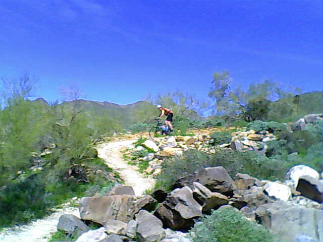
 Spent the last couple weeks patiently waiting... waiting for news from the district about my school and whether or not we're going to be closed next year (any decision was put off (again) until June 8)... for my kid's 5th birthday to arrive (just about 1 more week to go)... and for the woods to begin to open for spring riding.