18 April 2010

The wild telegraph poles of Dry Lake Hills [UPDATED]


I spent much of my childhood walking around in the woods looking down at my feet... wandering in the forest that surrounded our one-room family cabin near Walker, Arizona, in the heart of the Bradshaw Mountains south of the town of Prescott... looking for stuff. 

The Bradshaws had been mining country back in the old-days, long before my time there, beginning in the 1860s. And the remains of hundreds of mining operations, deep shafts and dark adits, gigantic mountains of poisonous yellow tailings (some now successfully reclaimed), trackless rail-beds, winding narrow roads, and old abandoned homesteads and their correspondent piles of broken stoneware, glass, and rusting metal were all abundant features on the landscape near our cabin.  Our place itself was part of an historic mining claim, and subsequently, while we owned the deed to the land for some 40 years, we never did possess the actual mineral rights.

I brought a lot of stuff back from my early wandering excursions around our cabin... cans, crocks, tools, and the like... and put it all under the front stoop, where it continued to rust and moulder, just as it had been elsewhere.  But it seemed the right thing to do at the time... to bring these curiously old things back with me and give them a new place... where they could regain some kind of utility, perhaps... if only as a young boy's novelty.

When I was in fourth grade I got my first motorcycle.  On it I was able to wander much further... Typically alone, but occasionally with my brothers in-tow, I was able to follow old roads and rail-beds much farther, was able to ride up and down way more and bigger mine tailings, was able to throttle aimlessly for hours at a time through what seemed to me to be a nearly endless woodland.  My objective was still to explore old mining operations, but now I brought much less back with me.  More and more, my compulsion grew toward simply finding things, not necessarily to retrieving or possessing them... just being out, nowhere, finding old places and old things... seeing them as they were left in-place so long ago... that was enough.

I'm still compelled like this.  But when I first moved to Flagstaff, I was puzzled.  The woods around here aren't like the woods around Prescott.  The woods here give up their secrets much more slowly, and often only after both figurative and literal layers of duff and detritus are carefully cleared away.  Here human history has taken a different path than it did further south.  Rather than the Bradshaw's granite rocks marbled with veins of silver and gold, the mountains near Flagstaff are volcanic... so there's almost no history of mineral extraction in the region.  Instead of miners, native people, first... then much later sheep herders and foresters... settled this country.  Like all people, they left a mark on the landscape.  But to an eye trained to see mines and tailings and abandoned roadbeds, learning to spot sheep camps, and potsherd, and tree blazes, required a lot of relearning.

I'm still learning.  After years of wandering around in these woods, I'm getting a little better at identifying old stuff.  Today, for instance, while I was out riding, I was forced, due to snow, to stop my ascent at the West Elden climbing area, just a little below the junction of Lower Brookbank and Middle Oldham trails.  As it happened, I stopped near an old telegraph pole (see E, below) that I've noticed, while riding past it, many times over the years. It looks just like a tree at first glance, but it's been shaved of its bark, hewn at a a sharp angle at the top, and has a couple large bolt holes drilled into it.  Easy to miss, but definitely not just a stump.

Thanks to excellent regional historians like Platt Cline and Donna Ashworth, I'm aware that the Upper Oldham trail... and thus probably some of the lower sections of the Elden Lookout Road, too... was part of a mule-skinners supply route for the fire tower at the top of Mount Elden in the days before the road was built.  I've always assumed that this pole followed the original alignment of the mule trail and functioned, long ago, as a communication line, and perhaps also as a power line for folks staffing the tower.

Before today, I was also aware of a second, much taller pole located some distance below this point, down on the Rocky Ridge trail.  This pole is easy to miss too, being, well,  also rather tree-like.  But it's definitely not a tree either.

So, today, rather than leave the trail, hike through the snow, and continue to ascend on the freshly graded road... something I will have plenty of opportunities to do as the season progresses... I decided to head back down, but through the trees instead, not on the trail, heading toward the other pole, to see how many more poles I could locate between them.  Following an almost straight line, crossing the road at one point, I was able to find 5 poles in all.  I took pictures of them, as some kind of proof, I guess, with my lame-but-undeniably-handy phone camera.  Five old poles and a fine sense of personal satisfaction. Just another Sunday in the woods.

UPDATE August 2026: Fires and floods (and subsequent flood-mitigation projects) have destroyed poles C, D, and E.


A
B
C
D
E
Map


Where the poles go in either direction above or below points A and E, I don't know. A task for another day.

See also: The wild telegraph poles of Dry Lake Hills (part two)

10 April 2010

What Josh Saw

My friend and Absolute Bikes coworker, Josh Kelly, of Josh Kelly Racing Inc. fame, took this picture about a week ago up on Mount Elden somewhere near the summit.  I've been riding locally a lot more regularly lately (home through the woods after work, most Saturdays, sundry Sundays, you know...), but I haven't been up that high yet this season. Not because I haven't wanted to ride up the Lookout Road, but because I simply haven't been able to find the couple hours needed to make the round trip.  Maybe tomorrow I'll head up... Hate to think I might miss out on seeing these 8-foot snowbanks for myself. [UPDATE 12 April: I never did make it up the mountain this weekend... rode out-and-back on a nearly bone-dry Rocky Ridge on Sunday instead... but another pal, Chris rode up and he got an equally impressive picture of the Mt. Elden snowbanks.]

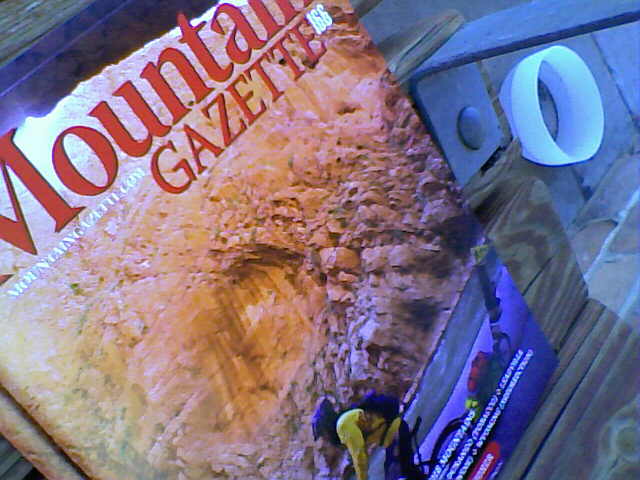
In other news: Got a small article about Mount Elden in the current issue of Mountain Gazette, #166.  It's the same piece I submitted to them not quite a year ago that they didn't pick up at the time.  Nevertheless, the editor was kind enough to actually hang on to it and, for whatever it's worth, he decided to run it in this season's annual pedaling issue.  I'm a genuine fan of Mountain Gazette.  It's a great, readable, interesting magazine whose writers and photographers never fail to captivate me.  As proof of my convictions: I've got two of their old covers matted and framed in my house (see below)... not because I was in either of those issues... this is the first time they've published me... but because they're just such awesome, evocative images.  I'm seriously thrilled to finally be able to say I've been a part of their magazine.

MG #125 MG #118

27 March 2010

First of a hundred days

Spent the last couple weeks patiently waiting... waiting for news from the district about my school and whether or not we're going to be closed next year (any decision was put off (again) until June 8)... for my kid's 5th birthday to arrive (just about 1 more week to go)... and for the woods to begin to open for spring riding.

Got up this morning just super-ready to get some exercise.  And, not being too excited about skiing the frozen cord and riding chilly chairs for a few hours at Snowbowl (not to mention being at the point in the season where another drive up the road to the area just seems so dreadful), I instead headed out into the woods on my bike this morning at around 8:30 for the first time since, like, November.

It's early in the springtime to be out riding.  No question.  But, we've been out in the woods as a family walking a few afternoons recently and we've seen that, while not completely melted off by any stretch, the woods near the base of Mount Elden are nevertheless growing more passable every day.  So, with the streams and waterfalls flowing all around me, I was able to get an easy-going hour in on the bike today riding on local trails (Lower Oldham and Jumps) and what can only be compared to solid rock, akin to slickrock but without the massive relief.

The snow's set-up totally solid at this point, no worries of punching through, no soft spots and no mud (except at stream crossings) if you get out before the temps top the mid-30s.  Riding the ice-cold snow-rock is slowish most of the time.  At this point there are still long stretches off-trail where you can ride for a quarter-mile, maybe more, on solid rock-hard snow... going uphill's a patient-but-reasonable low-gear grind. But, oh man, going downhill on these stretches, whipping around tree-wells and sun-cups, under low branches, in-and-out of halfpipe-like drainages, is pretty dang fun!  It makes these trails on the flanks of Elden, which I ride lots, easily well over a hundred days a year, year-in and year-out, totally new and exciting again.

22 March 2010

Just about a bike: Ibis Mountain Trials

This is my Ibis Mountain Trials.

I've owned this bike since 1996, which makes me it's longest-owner.  But I am not the bike's original owner.  I bought it from Flagstaff local-legend Steve Garro of Coconino Cycles fame, who owned it back in the day... before he was a world-famous frame builder.

Before that this bike was owned by another well-known Flagstaff Mutant, Rex Jenney, who ordered it through Cosmic Cycles, Flagstaff's original mountain bike shop, back in the early 1990s.

The spec sheet that I got from Steve when I bought the bike indicates "Prices effective 4/1/92"

However, the serial number on the bottom-bracket shell, 1087, would seem to indicate that the bike is actually of a slightly earlier vintage (around 1991, I think).

I used to ride this bike a lot, so it's not in pristine condition by any means.  But it's certainly a special bike, two different-sized wheels, uncommon geometry, handmade in Sebastopol by Scot Nicol, stuff like that.  Plus, it's got a few cool parts on it.  Over the years I've done my best to A) fix it up just a little, and B) keep it in decent condition while riding it on a regular basis.

When I got it it had never been painted, just primered... and then cleverly Sharpie'd by Steve.  Of the many things he wrote on it, my personal favorite was written in bold lettering on one of the seatstays: "Yes, the rear wheel is smaller!"

Click images to enlarge
I got a local auto painter to remove all the old primer and paint it a neat gray with blue-metallic overspray, put new decals on it, and finish with several layers of clear-coat.  It turned out great and looks especially cool in the sun.

The USA-built Mountain Trials bikes (Ibis also imported a less expensive Taiwanese version of both the Mt. Trials and the smaller 24x20" Trials Comp for a few years) were manufactured in only two frame sizes, 13" and 17". This bike is the larger of the two and it fits me, a six-footer, nicely.  

It's a spectacularly fun bike to ride in the woods here in Flagstaff. I used to take it down to Sedona all the time, too, and even rode it in Moab on a couple trips way back when. It's crazy good at riding up slickrock, but ('til you get the hang of it) kinda scary going down.

Like all Mountain Trials of this vintage, has a 26" front wheel and a 24" rear wheel, 15" chainstays, a 72 degree headtube, a 72.5 degree seat-tube, a 22.75" top tube, a 12" high bottom-bracket, and a 2x8 drivetrain with a milled-down outer chainring to act as a bash guard.  It's still got its original Koski fork and the original Salsa high-rise stem, too.

Needless to say, it's rather unique.  

Of all the bikes I've ever owned, it has been, hands-down, the most challenging one to learn to ride well.


17 March 2010

It ain't the "Pro Leisure Tour" but it ain't bad.

We're outta town for the most of this week, hanging in Snotsdale, AZ, my old hometown, for my Dad's 70th birthday, with much of the sum-total of our extended family, my brother and his family, and the grandparents, my folks, too... even great-grandma's made an appearance or two (She had commitments to play bridge with the gals today).  The other Flagstaffricans (my other brother and his family) are in California at Disneyland, which is what we did last year for Spring Break.

Between meals we've been doing the sort of big-city things big-city folk do, chiefly: shopping, snacking, and finding our way to trailheads on the "edges of civilization" for short-but-fun mountain bike rides.

Yesterday we rode a set of new-to-me trails in the McDowell Sonoran Desert Preserve in far-north-Scottsdale (Gateway, Bell and some of Windgate pass) and I took a few pictures with my still-new-to-me camera phone.  They're terribly low-res, but if you use your imagination, they kinda look like they went through the Photoshop watercolor-filter.
On Thursday (tomorrow) my Scottsdale-brother and I are planning to head back up to Flag for about 24 hours to spend Friday skiing with our Flagstaff-brother.  It's been too many years since the three of us shared the chair together.  So it should be fun.  I might even take a few more pictures!

After that we jet back down to the Valley on Friday evening for yet another birthday party (one of the cousins) on Saturday afternoon and (hopefully) another creosote-scented ride in the desert, too!

I know: it ain't the "Pro Leisure Tour" but, ya know, it ain't bad...

10 March 2010

Long-Mile-Legs - Playing with Google Bike Maps

The bicycling-related Internet-o-spere's all a-Twitter about the new bicycle routes feature on Google Maps that made its debut today.  Granted, it's a long-overdue addition to this already incredibly useful resource.  I'd heard the feature was coming some time ago.  But I'd kinda forgotten about it until I caught wind of it earlier today.

After work this afternoon, being somewhat less than totally stoked to head out right-away into the second straight day of near-blizzard-like conditions, I spent a little time running this new feature through its paces.

The good news is, in general, it seems to work.  It pretty much nailed what I'd call the safest route (though perhaps not quite the fastest) for my daily bike commute to and from work. 

But what really surprised me was when I requested a route from Flagstaff, Arizona, to Scottsdale, Arizona, the town where I grew up.

See, I actually tried to ride to Scottsdale once, back when I was really into long, lonely, road rides.  I got as far as Prescott the first day (a good century), going by highway through Williams, Ashfork, and Chino Valley into 25 MPH headwinds before bagging the whole affair, telling myself I'd return to finish it another day.

Well, it's been several years, and I've yet to complete the journey.  But I'd still like to.  Someday.  And today, I decided to ask the Google Maps Genie what route it would take.

I was, in a word, shocked by the results this seemingly simple query returned!  I figured it would route me down I-17 or I-40, maybe down Highway 89a through Sedona, or  across Lake Mary Road and then through Payson and down the Beeline... something sensible... on paved roads, ya know.  Instead, I got this monster-epic!  And, honestly, it really looks like fun.  It's a magnificent route!
And completely unexpected.
And totally impassable part of the year (like now).
And, to say the least, it's quite difficult to imagine it being done as a double-century by most normal human beings in the estimated time of 18 hours (and 27 minutes)!

But it just might make for a great multi-day endeavor one of these years.  Never know...

Just gotta get my long-mile-legs back under me, and then...

Start: Flagstaff, AZ
End: Scottsdale, AZ
Time: 18 hours, 27 minutes!
Distance: 202 miles
[download/view route as .pdf]
[view route in Google Maps]

Directions:
Start at: Flagstaff, AZ
1. Head east on Historic U.S. 66 E/I-40 BUS E/E Santa Fe Ave toward N Beaver St - 299 ft
2. Turn right at Beaver St - 0.3 mi
3. Turn right at W Butler Ave/W Clay Ave - 341 ft
4. Turn left at S Humphreys St - 331 ft
5. Turn right at W Dupont Ave - 36 ft
6. Turn left at W Dupont Ave - 0.6 mi
7. Turn right at University Dr - 121 ft
8. Turn left at Campus Heights St/Runke Dr - 0.2 mi
9. Turn right to stay on Campus Heights St/Runke Dr - 0.1 mi
10. Turn left at S Knoles Dr - 0.3 mi
11. Turn right at E McConnell Dr - 0.4 mi
12. Turn left at Fort Tuthill (Flagstaff Urban - University Heights to Fort Tuthill) - 1.4 mi
13. Turn left to stay on Fort Tuthill (Flagstaff Urban - University Heights to Fort Tuthill) - 0.6 mi
14. Turn right at Purple Sage Trail - 39 ft
15. Continue onto Forest Service Rd 532 - 1.1 mi
16. Turn left at Forest Service Rd 231/S Woody Mountain Rd Continue to follow S Woody Mountain Rd This road may be seasonally closed - 4.0 mi
17. Continue onto Forest Service Rd 231 This road may be seasonally closed - 2.3 mi
18. Turn right toward Forest Service Rd 231D - 131 ft
19. Slight left at Forest Service Rd 231D - 1.9 mi
20. Turn right - 1.2 mi
21. Turn left toward Forest Service Rd 530 - 2.8 mi
22. Turn right at Forest Service Rd 530 - 0.8 mi
23. Turn right to stay on Forest Service Rd 530 - 0.7 mi
24. Turn right to stay on Forest Service Rd 530 - 2.0 mi
25. Turn right to stay on Forest Service Rd 530 - 0.4 mi
26. Turn right - 322 ft
27. Sharp left toward Boy Scout Camp Rd - 2.2 mi
28. Continue straight onto Boy Scout Camp Rd - 0.1 mi
29. Continue onto Forest Service Rd 527/Thomas Loop Rd - 1.7 mi
30. Turn left at Garland Prairie Rd - 0.9 mi
31. Turn left - 0.5 mi
32. Turn right toward Fire Rd 139 - 2.7 mi
33. Continue straight onto Fire Rd 139 - 1.0 mi
34. Continue onto Fire Rd 14 - 5.6 mi
35. Continue onto Fire Rd 101 - 0.7 mi
36. Turn right at Co Rd 73/S Perkinsville Rd - 1.0 mi
37. Turn left at Bill Williams Loop Rd/Forest Service Rd 108 Continue to follow Bill Williams Loop Rd - 6.3 mi
38. Turn left at Bill Williams Loop Rd/Fire Rd 108 - 1.5 mi
39. Continue onto Fire Rd 186 - 8.3 mi
40. Turn left to stay on Fire Rd 186 - 2.1 mi
41. Continue onto Forest Service Rd 186 - 0.5 mi
42. Continue onto Forest Service 186 Rd - 1.7 mi
43. Continue onto Forest Service 492 Rd - 2.1 mi
44. Sharp left - 0.9 mi
45. Slight left toward Forest Service 9005 N - 1.4 mi
46. Turn right at Forest Service 9005 N - 2.7 mi
47. Turn left at Co Rd 137 - 0.7 mi
48. Continue onto Forest Service 635 Rd - 1.1 mi
49. Continue onto Co Rd 137 - 0.6 mi
50. Continue onto Forest Service 635 Rd - 2.9 mi
51. Turn right to stay on Forest Service 635 Rd - 5.9 mi
52. Turn right at Forest Service 641 Rd - 3.3 mi
53. Turn right at Forest Service 354 Rd/E Perkinsville Rd - 1.4 mi
54. Turn left at Forest 318A Rd/Narrow Guage Rd - 1.1 mi
55. Turn right at Bm 4882 - 2.5 mi
56. Slight left at Bm 4882 - 0.6 mi
57. Continue straight onto Poquita Valley Rd - 1.2 mi
58. Turn right at Poquito Valley Rd - 3.2 mi
59. Continue onto N Viewpoint Dr - 1.7 mi
60. Turn left at E Horseshoe Ln - 289 ft
61. Turn right at N Wildhorse Dr - 0.5 mi
62. Turn right at N Cattletrack Rd - 253 ft
63. Turn left at Mountainview Dr/Roundup Dr - 0.1 mi
64. Turn right at N Fulton Dr - 0.3 mi
65. Slight left at E Long Mesa Dr - 0.2 mi
66. Turn right at N Robert Rd - 2.1 mi
67. Turn left at E Lakeshore Dr - 269 ft
68. Turn right at N Tani Rd - 0.6 mi
69. Turn left at E Florentine Rd - 335 ft
70. Turn right at N Cochise Dr - 479 ft
71. Turn left at E Frontage Rd - 0.5 mi
72. Turn right at N Truwood Dr - 164 ft
73. Turn left at AZ-69 S - 13.8 mi
74. Turn right at E Hackberry Mine Rd - 0.2 mi
75. Slight left toward Main St - 0.9 mi
76. Slight right at Main St - 0.4 mi
77. Continue straight onto Central Ave - 0.6 mi
78. Turn right at Main St - 223 ft
79. Turn left to stay on Main St - 1.4 mi
80. Continue onto Antelope Creek Rd - 7.2 mi
81. Continue straight onto Crown King Rd/Forest 259 Rd - 2.8 mi
82. Slight left toward Crown King Rd - 1.3 mi
83. Slight left at Crown King Rd - 8.5 mi
84. Continue onto Maggie Mine Rd - 6.7 mi
85. Turn right at Old Black Canyon Hwy - 1.4 mi
86. Turn left at E K-Mine Rd - 443 ft
87. Turn right at Albins St - 0.1 mi
88. Turn left at Mud Springs Rd - 0.5 mi
89. Turn right at I-17 Frontage Rd - 0.3 mi
90. Turn left at I-17 Frontage Rd/Velda Rose Rd - 0.3 mi
91. Turn left at St Joseph Rd - 85 ft
92. Turn right toward St Joseph Rd - 1.5 mi
93. Turn left toward St Joseph Rd - 0.1 mi
94. Turn left at St Joseph Rd - 52 ft
95. Turn right - 2.7 mi
96. Turn left - 413 ft
97. Turn right toward Rd 46 - 1.4 mi
98. Turn left at Rd 46 - 1.5 mi
99. Turn right to stay on Rd 46 - 0.3 mi
100. Turn right - 2.8 mi
101. Turn right - 0.4 mi
102. Turn left toward Fr41 - 0.6 mi
103. Continue straight onto Fr41 - 0.3 mi
104. Turn left to stay on Fr41 - 0.9 mi
105. Turn right at W Table Mesa Rd - 1.0 mi
106. Turn left at N 35th Ave - 495 ft
107. Continue onto Old Stagecoach Rd - 0.4 mi
108. Slight left - 0.7 mi
109. Turn left - 0.2 mi
110. Turn right toward W Photo View Rd - 0.7 mi
111. Turn right at W Photo View Rd - 0.1 mi
112. Turn left at N 27th Ave - 1.0 mi
113. Turn left at W Mingus Rd - 0.1 mi
114. Turn right at N Rough Rider Rd - 0.5 mi
115. Turn right at N 23rd Ave - 0.3 mi
116. Turn left at W New River Rd - 4.0 mi
117. Turn right toward N Central Ave - 0.2 mi
118. Turn right at N Central Ave - 400 ft
119. Turn left at N 1st Ave - 0.1 mi
120. Turn left at W Leann Ln - 0.8 mi
121. Turn left at W Honda Bow Rd - 0.3 mi
122. Turn right at N 3rd St - 0.5 mi
123. Turn right at E Linda Ln - 75 ft
124. Slight left at N 3rd St - 0.2 mi
125. N 3rd St turns left and becomes N 7th St - 1.5 mi
126. Turn left at E Desert Hills Dr - 0.5 mi
127. Turn right at N 12th St - 2.5 mi
128. Turn left at E Galvin St - 0.3 mi
129. Turn right at N 14th St - 0.5 mi
130. Turn left at E Carefree Hwy - 4.9 mi
131. Turn right at N 53rd St - 0.2 mi
132. Turn left at E Olesen Rd - 240 ft
133. Turn right at N Cave Creek Rd - 0.1 mi
134. Turn left at E Yolantha St - 0.1 mi
135. Turn right at N 54th St - 0.1 mi
136. Turn left at E 7 Palms Dr - 0.3 mi
137. Turn right at N 56th St - 39 ft
138. Turn left at E 7 Palms Dr - 0.4 mi
139. Turn right toward N 60th St - 0.1 mi
140. Turn left toward N 60th St - 285 ft
141. Turn right at N 60th St - 0.4 mi
142. Turn left at Dove Valley Rd - 0.5 mi
143. Turn right at N 64th St - 0.6 mi
144. Turn left at E Cll De Las Estrellas - 0.2 mi
145. Turn right at N 66th St - 1.0 mi
146. Turn left at E Milton Dr - 0.6 mi
147. Turn right at N 71st St - 0.1 mi
148. Turn left at E Windstone Trail - 0.1 mi
149. Turn left at N Scottsdale Rd - 43 ft
150. Make a U-turn at E Mary Sharon Dr - 3.8 mi
151. Turn left at E Los Portones Dr - 0.7 mi
152. Turn left at E Pinnacle Peak Rd - 0.1 mi
153. Turn right at 76th St/E Happy Valley Rd/N Miller Rd Continue to follow 76th St/N Miller Rd - 1.0 mi
154. Continue onto Hayden Rd - 3.3 mi
155. Continue onto N Greenway Hayden Loop - 0.4 mi
156. Turn left at E Frank Lloyd Wright Blvd - 0.6 mi
157. Turn right at N 85th St/N Northsight Blvd - 0.3 mi
158. Turn right at N Northsight Blvd - 0.2 mi
159. Turn left toward N 87th St - 0.2 mi
160. Turn right at N 87th St - 0.5 mi
161. Turn left at E Raintree Dr - 171 ft
162. Turn right at N Pima Acc (signs for AZ-101 S) - 0.5 mi
163. Turn left at N Northsight Blvd/E Thunderbird Rd Continue to follow E Thunderbird Rd - 0.3 mi
164. Turn right at N 90th St - 1.0 mi
165. Continue onto N 89th St - 0.5 mi
166. Turn left at E Cholla St - 266 ft
167. Turn right at N 90th St - 0.1 mi
168. Turn left at E Gary Rd - 449 ft
169. Turn left to stay on E Gary Rd - 46 ft
170. Turn right to stay on E Gary Rd - 0.2 mi
171. Turn right at N 92nd St - 0.1 mi
172. Turn right at E Desert Cove Ave - 30 ft
173. Turn left - 1.3 mi
174. Turn left toward Arizona Canal - 2.6 mi
175. Turn left at E Krail St - 0.2 mi
176. Continue straight onto Arizona Canal - 0.1 mi
177. Slight left at N Lincoln Dr - 0.4 mi
178. Slight left at E Berridge Ln - 0.2 mi
179. Continue straight onto N Pima Rd - 0.8 mi
180. Turn right at E Bonita Dr - 0.1 mi
181. Turn right at E Orange Blossom Ln - 0.2 mi
182. Turn left at N 86th St - 256 ft
183. Turn right at E Pasadena Ave - 0.1 mi
184. Slight left at N 85th St - 289 ft
185. Turn right at E Chaparral Rd - 394 ft
186. Turn left - 66 ft
Arrive at: Scottsdale, AZ

06 March 2010

kid stuff (brag on)

It's a brag. But it's true. So I'm just gonna tell you: We've got a great kid! She's bold, funny, creative, and smart. And she's just a whole lot of fun to hang around with. She's almost five now. And this season, especially as the weather has been getting to be more and more spring-like, we've been trying to get her on the snow up at Snowbowl in order to help her learn how to ski. We went up again early this morning and made a few runs on the Aspen Chair on Hart Prairie.  Today her Mom (my wife, natch) went with us to shoot a little video from the sidelines.


We've had her out a few times before, including one day in the SkiWee program. Each and every time we've gone I've just been so impressed by her great attitude and the natural zeal that she carries into almost everything she does.


Last summer we spent a lot of time working on her bike riding skills. She seems to be super-gung-ho about riding her bike too, despite a few good wrecks, and scratches, and a mostly-grey'd-out front tooth. Nevertheless, it's always amazing to me to watch the sincere joy she's able to find in all these experiences.


As I've mentioned here before, we've also had a lot of fun riding around the tag-along Trail-a-Bike together. It's really amazing where we're able to go together on this rig.


We'd love our kid just as much, even if she hated bikes and skis. But it brings us great pleasure to watch her learning to enjoy for herself a few of the things we've enjoyed for so long. The best we can hope: they're things she's able to do and enjoy for a lifetime.

/brag
May your trails be crooked, winding, lonesome, dangerous, leading to the most amazing view. -- Ed Abbey

© John Taylor Coe
* ALL RIGHTS RESERVED *
2009-2026